Borobudur or Barabudur

Borobudur, or Barabudur, is a 9th-century Mahayana Buddhist monument near Magelang, Central Java, Indonesia. The monument comprises six square platforms topped by three circular platforms, and is decorated with 2,672 relief panels and 504 Buddha statues. A main dome, located at the center of the top platform, is surrounded by 72 Buddha statues seated inside perforated stupa.
The monument is both a shrine to the Lord Buddha and a place for Buddhist pilgrimage. The journey for pilgrims begins at the base of the monument and follows a path circumambulating the monument while ascending to the top through the three levels of Buddhist cosmology, namely Kāmadhātu (the world of desire), Rupadhatu (the world of forms) and Arupadhatu (the world of formlessness). During the journey the monument guides the pilgrims through a system of stairways and corridors with 1,460 narrative relief panels on the wall and the balustrades.
Evidence suggests Borobudur was abandoned following the 14th-century decline of Buddhist and Hindu kingdoms in Java, and the Javanese conversion to Islam. Worldwide knowledge of its existence was sparked in 1814 by Sir Thomas Stamford Raffles, then the British ruler of Java, who was advised of its location by native Indonesians. Borobudur has since been preserved through several restorations. The largest restoration project was undertaken between 1975 and 1982 by the Indonesian government and UNESCO, following which the monument was listed as a UNESCO World Heritage Site. Borobudur is still used for pilgrimage; once a year Buddhists in Indonesia celebrate Vesak at the monument, and Borobudur is Indonesia's single most visited tourist attraction
In Indonesian, ancient temples are known as candi; thus "Borobudur Temple" is locally known as Candi Borobudur. The term candi is also used more loosely to describe any ancient structure, for example gates and bathing structures. The origins of the name Borobudur however are unclear, although the original names of most ancient Indonesian temples are no longer known. The name Borobudur was first written in Sir Thomas Raffles' book on Javan history. Raffles wrote about a monument called borobudur, but there are no older documents suggesting the same name. The only old Javanese manuscript that hints at the monument as a holy Buddhist sanctuary is Nagarakretagama, written by Mpu Prapanca in 1365.[9]
The name Bore-Budur, and thus BoroBudur, is thought to have been written by Raffles in English grammar to mean the nearby village of Bore; most candi are named after a nearby village. If it followed Javanese language, the monument should have been named 'BudurBoro'. Raffles also suggested that 'Budur' might correspond to the modern Javanese word Buda ("ancient") – i.e., "ancient Boro". However, another archaeologist suggests the second component of the name (Budur) comes from Javanese term bhudhara (mountain).
The references about the construction and inauguration of a sacred buddhist building — possibly refer to Borobudur — was mentioned in two inscriptions, both discovered in Kedu, Temanggung Regency. The Karangtengah inscription dated 824 mentioned vaguely about a sacred building named Jinalaya (the realm of those who have conquer worldly desire and reach enlightenment) inaugurated by Pramodhawardhani daughter of Samaratungga. The Tri Tepusan inscription dated 842 mentioned about the sima (tax-free) lands awarded by Çrī Kahulunnan (Pramodhawardhani) to ensure the funding and maintenance of a Kamūlān called Bhūmisambhāra. Kamūlān itself from the word mula which means 'the place of origin', a sacred building to honor the ancestors, probably the ancestors of the Sailendras. Casparis suggested that Bhūmi Sambhāra Bhudhāra which in Sanskrit means "The mountain of combined virtues of the ten stages of Boddhisattvahood", was the original name of Borobudur.


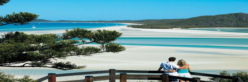
Java (Indonesia Travel Guides)Travel Guide to Indonesia (Holiday spots of tomorrow)

the Angkor Wat temples

Biking to see the Angkor Wat temples is a great way to experience the temples. If you have a good level of fitness, you should try biking to the temples!

The road to Angkor Wat is flat, so on that score it's pretty easy to bike. But it is rather long. It's 8 km to Angkor Wat, roughly another 8 km for the small circuit, and then finally 8 km going back to town.

Once you're at the Angkor Archeological Park, there are many signs directing you where to go. So it's easy to figure out where you next temple is.

Tips on biking to Angkor Wat

Having biked to Angkor myself, there are several things, and tips, that I think could make your biking experience more enjoyable (mine too, if I came up with this list sooner).

1. Get the right bike

This is probably what saved my life. I used a mountain bike, the one with multiple gears. Plus, my bike has a basket in the front where I put my backpack.

2. Get your temple itinerary straight

Since the Angkor Park is huge, you should make note on which temples you'd like to see. Even if you're going by tuktuk, they divided the visit into two: the big tour, and the small tour (petit or grand circuit).

With bike, it makes even more sense to prune and be ruthless with your choice of temples. It’s much better to enjoy the temples in leisure than try to see everything with an already tired body.

3. Bring an extra clothes for change
You will sweat like you never before. In addition to the actual physical exercise of biking, you have the added factor of the famously hot Cambodian sun. Most likely, your top will be totally wet, which could be uncomfortable.

4. Bring enough water
Bring only enough, because carrying too many water bottles will slow you down, and plus, there are lots of people selling cold water around.

5. Lunch within the park

When people visit the temples by any other types of transportation, they usually go back to Siem Reap for lunch and siesta. But since you're biking, it doesn't make sense to go back to town, then back after lunch to continue to visit. Well, unless you're really fit, then of course nothing is stopping you.

There are lots of great places for a relaxing lunch in the park.

So in short…

The whole point of biking to Angkor Wat is to enjoy it, and have a great time while doing it. Which is why I think a good level of fitness is a must.

Also, I would not really recommend biking there for first time Angkor visitors. THere's so much to see on your first day, and if you're biking and making yourself tired, you won't be able to enjoy the temples as much.

Enjoy!


Travel Cambodia – Phnom Penh, Angkor Wat, Sihanoukville
Cambodia is a land on the mend. From 1977 through 1980, the Khmer Rouge ruled the country, fanatics bent on genocide. Millions were killed and the period was put to film in the movie, “The Killing Fields.” Fortunately, those days are over and the country is becoming a tourist destination.

Cambodia is a land of incredible contrast. Thick forest, mountains and pristine rivers compliment amazing white beaches. When you get down to it, however, travelers know Cambodia for two things, Angkor Wat and the nastiest roads around. But, let’s not get ahead of ourselves.

Phnom Penh

Phnom Penh is the capital of Cambodia. The city is a combination of old French beauty and modern condominiums. The city is full of amazing Wats [Buddist monasteries], including Wat Ounalom, Wat Phnom and Wat Moha Montrei. Modern buildings surround these monasteries and it’s difficult to avoid a feeling that the old ways are being lost.

Still, the vibrancy of the city is impressive considering the fact that it was completely abandoned for three years in the last 70s. During this period, the Khmer Rouge tried to return the Cambodian people to their agricultural heritage and evacuated all cities. The only exception, of course, is Tuol Sleng, a high school used to torture and kill “enemies of the state.” Just beyond the city, one will also find the infamous killing fields where thousands upon thousands were put to death.

Sihanoukville

Sihanoukville is a small, sleepy village on the Southwest edge of Cambodia. Fairly undeveloped, the area is an oasis similar to the beaches of Thailand. The difference, however, is the lack of tourists. Depending on the time of year, the beaches can be more or less empty and privacy assured. Rooms run between $5 and $15 a night and come with private bathrooms. If you are looking to lounge professionally, Sihanoukville is a very good place to do it.

Angkor Wat

Stunning. There is no other word for the temples of Angkor Wat. Angkor Wat is a temple surrounded by hundreds of others. Each is unique and worth a look. The most famous are Angkor Wat, Bayon and Ta Phrom. Angkor Wat is in the best shape as well as the most known. The Bayon is impressive, but the constant mob of tourist makes it a pain to visit. Ta Phrom is amazing because it has been left to the jungle, which is to say trees and the structure have become one in many areas. If you have seen Tomb Raider with Angelina Jolie, you have seen Ta Phrom. Personally, I prefer Angkor Wat to the Pyramids in Egypt.

Roads From Hell

Cambodian roads are evil. There is simply no other way to put it. The country is hit by monsoons every year and is still recovering from the Khmer Rouge. This combination has resulted in roads with huge potholes, missing bridges and pretty much the worst elements of Dante’s Hell. Avoid them if at all possible!

Published At: Isnare.com Free Articles Directory - http://www.isnare.com/
Permanent Link: http://www.isnare.com/?aid=6266&ca=Travel

Mount Fuji The Sleeping Volcano

Mount Fuji or Fujisan is Japan’s highest mountain. The peak lies at 3776 meters which translates to 12,388ft. Its conical form, often snow-capped can be seen from both Tokyo and Yokohama providing of course the weather is clear. The shape is the clue, because Fuji, the Spiritual Mountain is a volcano. The last eruption was in 1708 so we can safely say Mount Fuji is presently dormant.

For the traveler who is perhaps using Japan as a stop over on a flight from either the US or Europe to Australasia time is probably in short supply. However, your stop-over will probably act as a foretaste of this incredible land of rugged terrain and rocky coasts, and not forgetting the fact that Japan is one of the few places in the world that enjoys four seasons. The easiest way to catch a good glimpse of the mountain is to take a train from Tokyo to Osaka. The Tokado line runs from the capita to Osaka via Nagoya and Kyoto; all places worth visiting during your stay in Japan. Approximately 45minutes after leaving Tokyo the train comes to Shin-Fuji station. This is the place to take photographs, so be sure you are on the right hand side of the carriage in order to see the towering, often snow capped peak of Japan’s premier mountain. Japanese trains are fast and efficient so the stop at Shin-Fuji will be brief and you will need to be quick in order to get your photographs. Unfortunately, too, the view can frequently be marred or even obscured by haze or cloud cover. this is especially so during the warm summer months, so maybe the best time to visit is the winter!

However, for those with more time, head out of Tokyo to the Fuji Five Lake Region that hugs the lower reaches of the mountain at an altitude of 3500 ft. This is a good base for climbing the mountain. To benefit from better weather conditions this is best done during the summer months of July and August.
Another alternative is to proceed to the hot spa resort of Hakone. Hakone is a favorite getaway spot from the hurly burly of bustling Tokyo, so expect the town to full at week-ends and during holiday time. From this lovely place with its lakeside setting you will get breath-taking glimpses of the upper reaches of a mountain that has inspired artists and sages over the centuries. If you want to go to the top, there is a motor road that goes half way up so you don’t need to get into training before heading off to Japan. Oh, yes, the best time to visit Hakone and the 5 Lake Region is during the month of June when the hydrangeas are in bloom, enjoy your trip!

Interested in this subject? Try this link for more of the same


Mount Fuji, or as the Japanese call it – Fujisan, is a dormant volcano and the highest peak in Japan. Sometimes referred to incorrectly in the West as Fujiyama, Mount Fuji is Japan's most famous mountain and a cultural icon. Throughout Japanese history Mt Fuji features heavily and one of the most famous depictions of the almost sacred mountain is the "36 Views of Mount Fuji" series of ukiyo-e woodblock prints by Katsushika Hokusai (1760-1849).

Some quick facts about Mt Fuji include that it is 3776 metres (12290 feet) high, approximately 161km (100 miles) south-west of Tokyo and that the last eruption of Mount Fuji was about 300 years ago, in 1707.

The busiest time to visit the mountain is July, when with Japanese schools have their holidays, however about a third of all climbers are foreigners. The snow capped pinnacle can quite treacherous outside of these months with freezing temperatures, avalanches and strong winds. When the snow melts in warmer weather it more resembles a lunar landscape covered with black volcanic rock.

Although many people have seen the well known photograph of Mount Fuji with the shinkansen bullet train barrelling through the fields in the foreground, perhaps the easiest and best way to get to Mt Fuji from Tokyo is by bus which only takes a few hours. The highway bus departs from Shinjuku station, however you may need to change buses at Kawaguchiko station. The official climbing season runs from July to August and crowds of young and old make the ascent each day. During this period there are around 15 buses each day leaving from Shinjuku in Tokyo. At other times transport can be limited and climbing Mt Fuji is not recommended anyway.

Even in the summer high season it is important you prepare for climbing Mt Fuji properly. Climbing experience is not required and you will see many small children and elderly folk along the way. Good study shoes, some water and energy snacks are a must, along with a raincoat, torch, hat and warm clothing if you intend to hike at night. Even in the warmer months the temperatures at the top can drop to around 6°C (43°F). If you are unsure about heights you may want to consider picking up some altitude sickness tablets and even some 'canned' oxygen which is available for purchase on the mountain or beforehand from stores in Tokyo like Shinjuku's Tokyu Hands.

The way up is divided into 10 stations or checkpoints. Generally visitors elect to start climbing about halfway up Mount Fuji on the Kawaguchiko trail at station 5. They arrive by bus or car and the climb takes around 7 hours to reach the summit and then another 4 to get back down again. The round trip can be completed in a very long day. Many people choose to begin their trek at nightfall and time it so they and arrive at the peak at dawn.

During July and August there are huts, toilet facilities and food stops open on the mountain in case you need to rest or take some time-out. But be warned, they can be rather pricy and a bit primitive so make sure to take a bit of cash with you too.

There is a famous Japanese saying that goes -- "You are a fool if you don't climb Mount Fuji, you are also a fool if you climb it twice."

On a clear day seeing the sunrise from this highest point in Japan is quite a breathtaking spectacle and is sure to be the highlight of your sightseeing in Japan. It's definitely a worthy side trip from Tokyo and the view from the top of Mount Fuji will be forever be etched in you mind. This is one experience that you do not want to miss on your visit to the land of the Rising Sun.

Published At: Isnare.com Free Articles Directory - http://www.isnare.com/
Permanent Link: http://www.isnare.com/?aid=57856&ca=Travel

Mount Everest

Generations of inhabitants have lived in the mountains through out the world. They have learned and mastered the behaviors of these mountains. These citizens have move towards to live easily in them and have urbanized techniques in order to shift securely all the way through and over them. These citizens are called "mountaineers" and this work out of their skill is called "mountaineering". When these mountaineers go up a scrupulous mountain with the aspiration of reaching its pinnacle, they turn out to be "mountain climbers".

The Mountain Climbing is in point of fact just fraction of the wider exploration action called mountaineering and for a very extensive time, these two were practiced only for the reason that they were helpful in skills. The climbing of mountains by the Mountaineers to liberate the trapped citizens or stray sheep. They used it for animals hunting in advanced terrain. Mountaineers would also direct travelers above not easy and over and over again high paths that they had to cross over. On the other hand, they would by no means do it for the sake of exploit or for fun. This was for the reason that they considered that there were monsters lurking in the advanced peak so they stay absent and live as shut up to the plains as they possibly can be.

On primary glance, a lot of citizens believe a stroll to the peak of the uppermost mountain in the world is leaving to be an existence altering experience. Is it? I have identified citizens who have come back from trying to get to the bottom camp of Mount Everest at 17,585 ft. They are overwhelmed with the magnificence natural attractiveness that they have seen. They have seen their acquaintances die trying to get high.

The first ever-winning climb of Mount Everest, the uppermost peak in the earth, is almost certainly the majority well-known scale in history. It was completed in the year of 1953 by a British voyage under the command of John Hunt Colonel. The Two members of the journey, that is Edmund Hillary who from the country of New Zealander and Tenzing Norkey who citizen of Tibetan, reached the peak on 29 May. Then 32 years previous to this huge attainment, eleven attempts to pinnacle were prepared and a group of lives were nowhere to be found. This built-in the enormous British climber George Leigh-Mallory and Andrew Irvine, his beneficiary climber. They were last seen heading for the peak of Mount Everest for the duration of their expedition in year of 1924.

The response to life’s troubles is not doing a number of deaths defying work out. Instead, you take your anxious personality with you to the work out. Maybe you breed from it or maybe you do not. You move toward back and think, ‘that was then, this is at the moment’. Your elderly personality takes hold another time and you are unable to find sight of the knowledge. As an alternative, people could do with a search within themselves. Try to find out what they require to do to calm down and acceptable attitude.

Published At: Isnare.com Free Articles Directory - http://www.isnare.com/
Permanent Link: http://www.isnare.com/?aid=232579&ca=Recreation


A Base For Green Issues

The world’s highest mountain has found itself at the centre of the global debate on the environment. In recent years, mountaineers at Everest Base Camp have attracted criticism because of the accumulated high-altitude litter left by summit expeditions. Environmentalists have also used changes to the environment on Mount Everest (8,848 metres) to highlight the issue of global climate change. But this publicity cuts both ways; it makes Everest both a cause for concern and a high-exposure platform for important green issues.

Tidying Everest

Tidying up at high altitudes is a difficult proposition. Beyond the altitude of about 7,000 metres, where the air gets significantly thin, climbers are understandably more concerned with lightening their loads and completing their journey than keeping the ground free of litter.

This is particularly the case beyond Camp 4 (7,920 m) where mountaineers make the final push to the summit, or are staggering back towards safety. Because of this, there has been discarded equipment and empty oxygen bottles accumulating for many years.

There have been a number of clean-up expeditions on Mount Everest (8,848 m). In 2000, National Geographic filmed an all-out clean-up effort on the mountain and even got Sharon Stone to do the voice-over for the documentary. Another full-scale cleaning trek from Everest Base Camp was organised by a Japanese team in 2007. Increasingly, mountaineers are encouraged to use recyclable metal containers, which feed Nepal’s scrap metal industry, and the toll for littering on Everest is being used to fund the ongoing tidying mission.

Despite these efforts, the outcry continues and the condition of the world’s tallest mountain has become symbolic of how we mistreat our natural wonders. Even the legendary Apa Sherpa, Everest trekking veteran with 19 Everest summits to his name, has used his fame to draw attention to the problem.

However, the emphasis of this concern has shifted more recently to focus upon the effects on Mount Everest of a more widespread problem. More alarming than litter (and less easily rectified) is the damage to the Everest environment being caused by global climate change.

And this is where the concerns of the environmentalists and the Everest community tend to overlap. The outdoor pursuits enthusiasts, mountaineers, and the adventure travel companies that conduct variations of the Everest Base Camp Trek all agree: they want to ensure the future of Nepal’s wonderful landscape.

Global Warming

It is easy to see even with anecdotal evidence how global warming is affecting the landscape around the Everest Base Camp Trek trails. For a while, the Sherpas have been reporting how the snow caps have retreated, and Greenpeace have issued a ‘before and after’ image comparing a photograph of the Rongbuk glacier taken in 1968 to how it looks today. The reduction of the ridges of snow and towers of ice is clear to see, and similar changes have been recorded on mountains thousands of miles away, such as Mount Kilimanjaro (5,893 m) in Tanzania.

Whatever the cause for this change, the importance of glacial melting should not be underestimated. The melt-water from Himalayan glaciers provides the water volume for the Indus, Yangtze, and Ganges rivers and affects the populations that depend upon that water. If the Himalayan glaciers melt considerably, it could mean dangerously increased flooding along those rivers, followed by severe long-term water shortages.

Again Everest trekking luminaries such as Apa Sherpa are outspoken on the cause. Following on from his Eco-Everest climb in 2009, his next expedition this month will be to climb an unnamed (and possibly unexplored) Nepalese peak. He will likely be armed with his banner for the summit photographs: “Stop Climate Change – Let the Himalayas Live!”

The Mystery of Stonehenge

5000 years ago at a site near Amesbury, Wiltshire in England, someone decided to dig a serious of circular holes. Each of these holes was around a metre deep, a metre wide, and formed a part of a circle of 284 feet in diameter. Although human remains have been found, it is thought that the holes, known as ‘Aubrey Holes’, where originally excavated for some kind of religious ceremony. For whatever reason, the site was abandoned soon after its conception, and remained untouched for another 1000 years.

Then another ‘Bright-Spark’ had the brilliant idea of building a stone henge. Now, some of the rocks weighed around 4 tons, and just to make things a little more interesting, it was decided to bring in bluestones from the Preseli Mountains in Wales, some 240 miles away. Bear in mind, 4000 years ago a low-loader was out of the question. How they were moved, no-one knows for sure, but it is generally believed that the huge rocks were first inched along the coast of South Wales on rollers. That in itself is astonishing, but when you hear that the rocks were then loaded on to rafts and sailed up the rivers Avon and Frome, it becomes an almost superhuman effort. Back to the rollers again to move them overland to a place near modern day Warminster, then once more onto rafts to transport them on the River Wylye to Salisbury, and if that wasn’t enough, they then dragged them overland to where they are today. Let’s face it, no-one is going to move them again in a hurry. Imagine that journey, then multiply it by 82. Yes 82, that’s how many bluestones were moved from Wales, not counting any that may lie on the seabed through mishaps.
Anyway, after everyone had a nice cup of tea, the rocks were arranged in an incomplete double circle. The ‘Avenue’ was formed which aligned with the midsummer sunrise, and a pair of ‘Heel Stones’ were erected. Some of the stones were used as lintels, and if you’ve ever seen pictures of Stonehenge, it defies belief how these were ever lifted into position.

Why did they do it? Why did they go to all that trouble to create whatever Stonehenge is? I doubt very much that we’ll ever know with complete certainty, although the idea of a place of worship seems the most likely. There are other theories of course, such as the huge calendar idea. One of the problems is that Stonehenge was built by a culture with no written language, so there are no rock carvings to decipher. Over the years, the mystery of Stonehenge has been the focus of many books and debates, which have spawned some interesting theories. It’s not difficult to find someone who honestly believes that the rocks were placed in position by some extraterrestrial intelligence, or by time travellers who have yet to be born, but let me give you my theory; they’re nutters, and as for Stonehenge, I’m not even going to hazard a guess.

A more palatable theory was proposed by Mike Parker Pearson, the head of the Stonehenge Riverside Project. He suggests that Stonehenge was joined to Durrington Walls which lies two miles to the east. Durrington was the land of the living whilst Stonehenge was reserved for the dead, the journey between the two being the transition from life to death. Geoffrey Wainwright, of the Society of Antiquaries of London, and Timothy Darvill believe that Stonehenge was a place of healing.

It’s difficult to see how anyone can own such a place as Stonehenge, so let’s say that it has been looked after by some notable people, none more so than Henry V111, who having acquired Amesbury Abbey, gave Stonehenge and the surrounding land to the Earl of Hertford in 1540. It then passed to Lord Carleton and then to the Marquis of Queensbury. In 1824, the Antrobus family purchased the estate, but when in 1915, their last heir was killed during World War 1 they sold it by auction to one Cecil Chubb for £6,600, who subsequently handed it on to the nation.

1920 saw a nationwide appeal aimed at saving Stonehenge from being swallowed up by modern buildings, which were springing up in the vicinity. An aerodrome had been built during the war, and a road junction had appeared perilously close to the stones. In 1928, the land around Stonehenge was given to the National Trust in order to preserve the integrity of the landscape. Stonehenge was voted one of the Seven Wonders of Britain in 2002.

Published At: Isnare.com Free Articles Directory - http://www.isnare.com/
Permanent Link: http://www.isnare.com/?aid=326752&ca=Travel


Saint Peters Basilica

Saint Peters Basilica
For many, treating unwanted and unsightly venous disorders is a part of life. Genetics and poor health and fitness lifestyle habits have led to an influx of patients all over America who are seeking health care to eliminate veins which are visible from beneath the skin. With modern medicine, there are treatment options which can help to eliminate unwanted visible veins.

The removal of spider veins in St. Peters, Missouri is a growing field of treatment which vein doctors have been striving to improve and master. With modern techniques now available, vein doctors in St. Peters can offer effective and viable treatment options which are actually minimally invasive and which support healthy looking legs. Sclerotherapy is a treatment option which has been around for some time now and which involves the use of injections to cause veins to undergo fibrosis. This treatment has been popular and still is, yet it is more difficult to treat veins with injections which are smaller since the needle cannot access smaller veins as well. With this challenge, doctors and medical researchers have been working on the removal of spider veins in St. Peters and have found alternate ways to effectively eliminate veins.

Since spider veins are not necessarily functioning veins, removing them is by no means a negative medical decision. Where sclerotherapy cannot access smaller veins, laser treatments can. With the advent of laser therapy, patients have the freedom to eliminate smaller veins in very little time. As a minimally invasive vein treatment in St. Peters, laser treatments are quick and have very few side effects. Minor pain, bruising, and swelling can occur after treatments and these effects quickly subside. The veins gradually disappear and the body’s own immune system breaks down the blood inside to reveal healthy and clear skin.

The removal of spider veins in St. Peters is becoming a popular medical treatment since many individuals find themselves susceptible to veins popping up either due to genetics, fitness and diet, or weight gain. It has long been thought that veins are linked to genetics and that having family members with visible veins may be a precursor to developing them. It is also true that weight gain and undue pressure on the legs contributes to visible veins. During pregnancy, women note an increase in the visibility of their veins. These veins may or may not subside once the pregnancy is over. It is important to be aware of weight gain and how this facet of lifestyle and diet can contribute to an unhealthy circulatory system. All of this is part of preventing veins from becoming an eye sore. Furthermore, one’s diet can contribute simply due to its ability to result in high levels of weight gain. Keeping the body at an optimal weight is the best way to prevent spider veins from occurring. Additionally, fitness and a regular work out routine protects the heart and veins throughout the body. Where such measures fail and genetics kick in, removing spider veins in St. Peters, Missouri is possible.

Published At: Isnare.com Free Articles Directory - http://www.isnare.com/
Permanent Link: http://www.isnare.com/?aid=254972&ca=Medicines+and+Remedies


The CN Tower

Defining the world's tallest building or the world's tallest tower has historically been a bit of a bumpy process. The debate focused on what should be defined as a building or tower, and what part should be measured. One tower that has been a central focus of the debate is the CN Tower.

The CN Tower was built by the Canadian National Railway. A popular tourist destination located in the city of Toronto, Ontario, Canada, the CN Tower, stands at a height of 553.33 meters, 1 815 ft. During construction in 1975, it overtook the height of Moscow's, Ostankino Tower, making it the tallest free-standing structure in the world. It held the record until recent years where it lost its famous title and is now no longer identified as the tallest tower in the world.

In 1995, the American Society of Civil Engineers declared the CN Tower as one of the modern "Seven Wonders of the World." Guinness World Records labeled the CN Tower as "the world's tallest self-supporting tower" and "the world's tallest free-standing tower." In 1996, Guinness changed the tower's classification to "World's Tallest Building and Freestanding Structure."

The Petronius Platform oil platform in the Gulf of Mexico is taller than the CN Tower standing at 609.9 meters, 2,001 ft, but a large part of the structure is located underwater. Emporis and the Council on Tall Buildings and Urban Habitat labeled the CN Tower as "the world's tallest free-standing structure on land."

After being famous as the largest free-standing structure in the world for 31 years, in 2004, the Taipei 101 in Taipei, Taiwan, which stands at 508 meters, gained the title, ‘Tallest-Building.’ On September 12, 2007, The United Arab Emirates' building, Burj Dubai, which was still under construction, overtook the record by reaching 555 meters tall. The actual designation became certified as the "Tallest Building in the World" when the building officially opened on January 17, 2009. Burj Dubai in Dubai reached 818 meters, 2684 ft., in height. Although, the Burj Dubai has its 124th-floor observatory, 442 meters in height, the CN Tower's Sky Pod is 447 meters above ground.

The CN Tower attracts about 2 million visitors each year. Things to do in the tower include watching a film about the tower’s construction, walking on glass floor, having a delicious meal 1000 ft above ground at the revolving 360 Restaurant, and enjoying the spectacular view. On a clear day, visitors to the CN Tower's observation deck can view over 160 kilometers (100 miles.)

Interesting facts about the tower include: It opened to the public on June 26, 1976, six glass-faced elevators travel at 22 km/hour (15 miles/hour) to reach the observation deck in 58 seconds, the glass floor was the first of its kind when it was opened in June 1994. It is 23.8 square meters (256 sq. ft.) of solid glass. The 360 Restaurant makes a complete rotation every 72 minutes.

For over 30 years, the CN Tower held the record for the tallest free-standing structure on land. The Tower now stands as the second-tallest free-standing structure on land in the world.

Published At: Isnare.com Free Articles Directory - http://www.isnare.com/
Permanent Link: http://www.isnare.com/?aid=390587&ca=Society


Chichen Itza And More

There is a reason why Chichen Itza again tops the list of 7 wonders of the world. One very good time to have a reading is at the change of the season, like vernal equinox and summer solstice. ChichenItza was built to maximize the equinoxes.

Another good time to have a reading is when you're in a transition - divorce, marriage, a new baby, a new job, a move to a new location.

Of course it's a good time to have a reading at your birthday. You can find out what lies ahead in the beginning of your own personal New Year, and don't forget to check this out regarding loved ones as well. Bosses and other important people too!

Which brings up the point that it's great to have a reading when you don't know what's going on with someone. If you can't figure out that Capricorn boss, or where your Scorpio lover has crawled off to, LOL.

Readings are good when you can't get the answer. If you're in the battle of the experts and everyone's telling you different advice, why not go to the Source?

It's a good time for a reading when you're bored, and things are stagnant. You can find out why, when it will lift, if there is anything you should or can do about it, and how to cope in the meantime.

Mercury Retrograde is a very popular time for readings. (When my calendar overflows, that's when I know it's Mercury Retrograde). That's when, for all of us, communications are screwed up. Faxes don't go through, people hang up on you, disastrous emails get sent, people don't show up at all, or go to the wrong place at the wrong time, traffic is snarled, batteries die and appliances don't work. These last for several weeks and occur several times a year. It's good to be prepared for them, and good to get readings during that time so you can maneuver through the landmines better.

You'll really want to get a reading at your Saturn Return (and important people in your life). This occurs for each of us around the age of 28-30, and then it comes around again at 58-60, where we -- if we know what's going on -- get the Big Second Chance. Very important to know about this so you can maximize this fantastic opportunity in your life.

Of course eclipses and full moons are a popular time for readings. Don't forget to get a reading right After A FULL MOON. That's when it all shakes down.

And don’t forget VENUS RETROGRADE. Once every 18 months, it brings in major changes. Get a reading and be prepared. You can lose a love relationship, have one transform. Women can cause problems in your life – his ex-wife starts acting up, some women goes after your job, or your man. It can also bring old loves back into your life. Really an exciting time, if you have a “good one,” and a reading helps prepare you.

Another great time to get a reading? Yesterday. Then you'd know what's going on today. :-)

And last but not least, a particularly good time to get a reading is when the thought occurs to you. There's a reason why. It's not an 'accident.' So pick up the phone, or email, and get a reading. You may find a happy surprise.

Published At: Isnare.com Free Articles Directory - http://www.isnare.com/
Permanent Link: http://www.isnare.com/?aid=172516&ca=Advice


Just over 100 miles from the glamorous resorts and pristine beaches of Cancun, rests Mexico’s most celebrated historical site. Chichen Itza, once a prominent regional capital of the Mayan civilization, is a sprawling complex of pre-Columbian ruins. Though the city lay neglected until archeologists began exploring and preserving the site in the 1920s, the Mayan capital has become one of Mexico’s most visited attractions. Chichen Itza – meaning “at the mouth of the well of Itza” – is also a World Heritage Site and finalist for the New Seven Wonders of the World.

The most well-known structure at the Chichen Itza site is the Temple of Kukulcan, also known as El Castillo. In addition to being one of the most famous remains of the Mayan civilization, this wonderfully preserved step pyramid once served as a monument to the culture’s greatest mythical creature. Kukulcan, the feathered serpent deity more commonly known as Quetzalcoatl, is celebrated in an incredibly unique architectural flourish. During the spring and fall equinoxes, the structure casts ornate shadows in the form of a feathered serpent along the northern staircase.

Demonstrating a common Mesoamerican architectural tradition, El Castillo was actually constructed atop another smaller temple. At the base of the northern staircase, visitors can enter a tunnel to the interior temple. The small room at the top of the staircase still houses King Kukulcan’s Jaguar Throne, carved from stone and painted red with jade spots.

These temples are at the heart of the debate surrounding the age of the city and the year of its decline. For decades, it was believed that the interior temple dated to a period just before 1000 AD, soon after the ruler of the Toltec civilization of central Mexico – who would later call himself Kukulcan in honor of the god – came to Chichen Itza. The historical belief held that Kukulcan, working with his Mayan allies, expanded Chichen Itza into the most powerful city in the Yucatan region. While many of the remaining structures at Chichen Itza represent a mixture of Mayan and Toltec styles, advanced technology has shown that the city most likely rose to prominence around 600 AD. Furthermore, while Mayan chronicles reference a revolt and civil war in 1221 – the previously held date of Chichen Itza’s decline and Mayapan’s rise – archeologists now believe Chichen Itza may have fallen by 1000 AD, creating a mysterious historical gap between the peaks of these Mayan capitals.

El Castillo and its inner structure are not the only temples at Chichen Itza. The High Priest’s Temple – a smaller version of El Castillo – served as the burial site for elite members of society. The Temple of the Warriors is another well-preserved step pyramid surrounded by carved columns with depictions of Mayan fighters. The Temple of the Warriors is also near the large plaza now known as The Great Market.

To the northwest of El Castillo is a large open space that might seem like another market at first glance. However, this area is the largest Mesoamerican ballcourt in all of Mexico, measuring 545 feet by 232 feet. The field is lined with sculptures of athletes, most notably a depiction of the losing team captain being decapitated. On the ballcourt’s exterior wall, The Temple of the Jaguar and another jaguar throne – similar to the interior of El Castillo – were built into the structure.

Another pair of popular structures is the complex known as Las Monjas (The Nunnery) and El Caracol (The Snail). Though referred to as a nunnery by Spanish conquistadores, Las Monjas was actually the primary governmental palace of Chichen Itza. El Caracol – a large round building on a square platform – served as the city’s observatory.

Called “the snail” for its spiral staircase, the Mayans incorporated many unique features into El Caracol. From the doors aligned for viewing of the vernal equinox to the stone cups designed to hold water and reflect the stars, Mayans based their understanding of the universe on this observatory’s technology.

Whether you visit Chichen Itza on your own or with a tour group, getting to the site from Cancun is a breeze. Tours can be arranged directly through your resort and most feature knowledgeable guides. However, guided day tours don’t always allow much free time at the site. If you want to explore the site on your own schedule or just beat the early afternoon crowds, consider renting a vehicle or spending a night at the pleasant villa near the ruins.